 Strongly jointed metagraywacke in the Rocky Islands with a siltstone "bathtub ring".
The Geologic History of the Billy Goat Trail
The Billy Goat Trail was primarily formed as a result of the Taconian Orogeny; the first mountain-building event in ancient North America. The dominant rock, greywacke, was formed by the subduction of the Iapetus oceanic crust under North America. Because of this subduction, an accretionary wedge of greywacke was formed between the contact of the two plates. The greywacke was also deposited by turbidites. Where is this evidence? The plethora of graded beds along the trail.

Upside-down graded bedding in a lithic metagreywacke.

Graded bedding with a central fault.

These three photos are all examples of graded bedding and evidence of turbidites. This type of bedding is formed by sediment particles settling out into a coarsening to fining sequence (bottom of rock to top).
The greywacke was then metamorphosed 460 million years ago during the first mountain-building event between ancient North America and a volcanic island arc, the Taconian Orogeny. This is when the oceanic sediments began to transition into the rocks that are commonly associated with mountain belts: metamorphosed, deformed, and granitic. In some rocks, metamorphic foliation is visible. This type of foliation occurs when oceanic sediments get caught between two colliding land masses and experience differential pressure. 100 million years after the first orogeny came the collision between North America and a micro-continent; this was called the Acadian Orogeny (360 Ma). This is important because the lamprophyre dikes (discussed later) were a result of this orogeny.
Lithology
Towards the beginning of the trail, greywacke is dominant then schist-grade metagreywacke (460 Ma) is seen. As the metamorphism becomes higher-grade, we began to see gneissic and granitic rocks. Finally we saw migmatites, or greywacke rocks produced through partial melting. Overall, the farther you travel down the Billy Goat Trail, the higher-grade of metamorphism you will see.
Non-Local Rocks & the Culpeper Basin
As previously mentioned, the rocks of the Billy Goat Trail are primarily metagreywacke; however, there are some non-local rocks that were found along the trail:


Stereonet of lamprophyre dikes.

Stereonet of bedding.

Stereonet of foliation.
Other Significant Geologic Features

Folding (a secondary feature - forms when the rock deforms).


Metasomatism, possibly with silica added.

This amphibolite is approximately 0.5 billion years old!
A noticeable amount of amphibolites are found along the trail that are parallel to the folds in the metagreywacke. There are two hypotheses for how they got here: The first is that they are scraps from oceanic crust, while the second is that instead they are mafic sills that intruded into the metagreywacke; this implies two very different ages. With the first scenario, the horizontal oceanic crust would be overlain by the greywacke which would imply that the oceanic crust is older (according to the principle of original horizontality). In the second scenario, mafic magma would be intruding into the greywacke which would suggest that the greywacke is older. There is not enough evidence to come to a conclusion; however, there is an indicator that supports the second hypothesis. The amphibolites are finest-grained at the edge and coarsest-grained in the middle; this is characteristic of an igneous intrusion because of the more rapid loss of heat at the edges.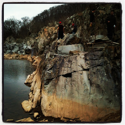
High-water silt line caused by changes in water level.

Alternating banding with boudins in quartz veins + parasitic folding.
...And finally...

The falls.
As previously mentioned, the rocks of the Billy Goat Trail are primarily metagreywacke; however, there are some non-local rocks that were found along the trail:
- Quartzite with skolithos tubes: These Cambrian-aged metamorphosed sandstones originally came from the Antietam Formation in the Blue Ridge province near Harper's Ferry. These large cobbles were transported during periods of high energy along the bed load of the Potomac River, which crosses the ancient rift valley.
- Arkose/Seneca sandstone: These "random" pieces of arkose found imply that they come from a rift valley or basin due to its short deposition time. They were a part of the Seneca sandstone. 200 million years ago, Pangea began to break apart. The weakest rift zone during that event eventually turned into the largest rift zone, thus leading to the birth of the Atlantic Ocean. Smaller rifts during the break up of Pangea became failed rifts, such as the Culpeper Basin, and quickly filled up with sediment. This rifting took place during the Triassic and Jurassic periods, which is why dinosaur footprints can be found in the Culpeper Basin due to the rapid burial that took place. Now, let's say that the Culpeper rift did not fail but instead succeeded--then the Billy Goat rocks would be in northwestern Africa and the Atlantic Ocean would be the Culpeper Ocean! The Smithsonian Castle in Washington, D.C. and brownstone row houses are built from the Seneca sandstone. Why are they built from the sandstone and not the metagreywacke? The metagreywacke here is pre-Appalachian mountain building material while the Seneca sandstone is post-Appalachian mountain building; therefore, it is easier to cut the sandstone out as opposed to the older rocks.
Lamprophyre Dikes
From the Maryland side of the trail looking onto the Virginia side, four undeformed lamprophyre dikes can be seen across the river. These mafic dikes are filled with lamprophyre, a basaltic rock which contains large flakes of biotite mica. The unstable, iron-rich micas broke down by oxidation more quickly than the metagreywacke they cut through. Potassium argon dating of the mica contributed to finding out the absolute age of the dikes--360 Ma; the same age as the Acadian Orogeny. This is evidence that the dikes were structures left during this orogeny.

Lamprophyre dikes on the Virginia side.

Weathered lamprophyre dike on the Maryland side.
These dikes should be located on the same plane on the Virginia but are not; they have been offset by 30 feet. There are two hypotheses to explain the reason of this offset:

Hypotheses for the offset of the lamprophyre dikes (Bentley).
A) The dikes were originally straight then cut by a fault along the bottom of the river.
B) The dikes were not originally straight, but jagged, to begin with.

Hypothesis "A" can supported by how straight Mather Gorge is, a feature that is explained by a fault. Rivers can cut through fault breccias more easily than hard rocks, like the San Andreas fault in San Francisco. With the rapid currents of the water and the amount of cobbles and boulders on the bed load, it is difficult to gather evidence through processes like shearing. Since dikes are not always straight and sometimes travel through uneven fractures, hypothesis "B" can be supported as well. My personal opinion is that I believe the dikes were originally straight then cut by a fault; this would explain why Mather Gorge is so unusually straight. For comparison, the valley that the San Andreas Fault runs through is remarkably straight. According to the USGS, long straight slopes and narrow ridges are distinctive landforms that the San Andreas Fault possesses. This is similar to the structure of Mather Gorge.

Stereonet of lamprophyre dikes.

Stereonet of bedding.

Stereonet of foliation.
Other Significant Geologic Features
- Folds: Stress is the force applied; strain is the non-recoverable response to stress. This leads to deformation in the rock, i.e. folding.

Folding (a secondary feature - forms when the rock deforms).

Ptygmatic ("intestine-like") folding, typical of migmatites.
- Tension gashes (or what I like to call "tiger scratches"): These secondary features occur when the rock stretches or dilates open to create fractures and get filled in.

- Metasomatism: These fractures appear to be raised. This is due to the rock on either side of the fractures being very tough; the toughness decreases with increasing distance from the fracture. This occurs when hot water squirts through a fracture and affects the rock next to the fracture.

Metasomatism, possibly with silica added.
- Amphibolites:

This amphibolite is approximately 0.5 billion years old!
A noticeable amount of amphibolites are found along the trail that are parallel to the folds in the metagreywacke. There are two hypotheses for how they got here: The first is that they are scraps from oceanic crust, while the second is that instead they are mafic sills that intruded into the metagreywacke; this implies two very different ages. With the first scenario, the horizontal oceanic crust would be overlain by the greywacke which would imply that the oceanic crust is older (according to the principle of original horizontality). In the second scenario, mafic magma would be intruding into the greywacke which would suggest that the greywacke is older. There is not enough evidence to come to a conclusion; however, there is an indicator that supports the second hypothesis. The amphibolites are finest-grained at the edge and coarsest-grained in the middle; this is characteristic of an igneous intrusion because of the more rapid loss of heat at the edges.
- "Bathtub ring":

High-water silt line caused by changes in water level.
- Boudinage (French for "sausage"):

Alternating banding with boudins in quartz veins + parasitic folding.
...And finally...

The falls.
References
Bentley, C. Billy goat trail pre-trip readings. Retrieved from
http://www.nvcc.edu/home/cbentley/gol_135/billy_goat/readings.htm
U.S. Geological Survey (1997). The San Andreas Fault - V. Surface features. Retrieved from http://pubs.usgs.gov/gip/earthq3/surface.html
Bentley, C. Billy goat trail pre-trip readings. Retrieved from
http://www.nvcc.edu/home/cbentley/gol_135/billy_goat/readings.htm
U.S. Geological Survey (1997). The San Andreas Fault - V. Surface features. Retrieved from http://pubs.usgs.gov/gip/earthq3/surface.html
Very informative. Your pictures could illustrate a text book. You seem fascinated by geology- maybe you should get some sort of geology internship while in school. Oh wait, I guess you already have one...
ReplyDelete